Saturday, November 28, 2020

Back Home on Land

I left Intermezzo in Hilton Head SC on Monday morning and flew back to my land home on The Ranch near Penngrove CA. I enjoyed a limited, socially distanced family gathering on Thanksgiving and am now easing into the transition from life at sea to life on land. It seems easier this time for me than in the past. My personal life is less complicated now and perhaps I'm getting better at negotiating my way through change.

Lisa is taking care of Intermezzo for a week or so longer until she heads back home to Arizona for the holidays and ski season (she's a private ski instructor). She'll do the final buttoning up of the boat based on a checklist I left with her and guidance/verification via FaceTime. Hopefully, all our mold/mildew abatement and prevention measures will be effective and it won't be much work to "unpickle" the boat when I return in January. 

I've spent some time reflecting on the cruise from Montauk NY to Hilton Head that began on October 21. No big revelations, no strong feelings arise. It was mostly a pleasant trip at a steady pace, not too fast, not too slow. There was little actual drama, though I did my best to create suspense every time we passed under a bridge and for every adverse weather system we experienced. I enjoyed all the places we dropped anchor and all the marinas we stayed in, except for the first one we stayed at in Charleston. Intermezzo performed well, the vibration from the propellers went away, I improved my upwind sailing performance, but water pump failures continue to be an annoyance. Despite her bouts with seasickness and nautical narcolepsy, Lisa was a good crew member and companion who treated me and Intermezzo very well. I will particularly miss the decidedly unhealthy but decidedly delicious egg sandwiches she made me for "elevenses".

So, nothing big to share philosophically about this trip, but a few discoveries seem worth reporting.

I prefer the "outside". Once we made the passage from Montauk to Norfolk VA, most of our trip was along "inside" along the Intracoastal Waterway (ICW). I'm glad to have experienced boating and life along the ICW and there are many aspects I enjoyed, especially the vast marshlands and birds. The miles of motoring along narrow canals and creeks can get tedious though, punctuated by the frequent unpleasantness of passing powerboats with big wakes. Sometimes it felt like I was driving slowly on an interstate highway through the flatland of the midwest. The ICW also felt like a very American thing to experience, positive in terms of its efficiency and hospitality, negative for me as having very suburban "sliced whitebread" characteristics. Ocean passages remove you from all that, just you, your boat, your crew, the ocean, the weather. Plus you sail 24 hours per day, rather than eight which puts more miles under the keel and allows for more time for R&R in port. In future trips, I'll opt for waiting for weather windows to do outside hops between inlets and enjoy downtime and exploring local waters in between.

I enjoy single handing.  Since we were only sailing eight hours a day on the ICW and Lisa got seasick on the two ocean passages we made, I ended up doing most of the sailing on my own. I enjoyed the planning, focus and discipline single-handing requires and this trip gave me opportunities to hone my skills. There were a couple times when I'm not sure what I would have done without Lisa, like when our anchor dragged in a storm and when docking with strong wind and/or currents, but the rest of the time I felt competent and comfortable, although it tired me out more quickly compared to double-handing.

Meditation makes sailing better. I've practiced meditation for over four years now, guided and influenced by the teachings of Sam Harris through his Waking Up app. One of the most important lessons Sam teaches is to pause throughout the day to step back and observe, become fully aware of what is happening, what you are doing, what you are thinking, how you are feeling. These brief pauses provide opportunities for more clarity, opportunities for you to respond differently than your conditioning causes you to react. During this trip I took many such pauses to be fully aware and I saw more beauty, felt less stress and enjoyed the present moments while sailing. I was far less distracted by my thoughts, which often compromise my happiness and enjoyment of sailing. My journal is filled with descriptions of the sea, sky, animals, weather, light, smells, sounds, small moments of beauty that normally would pass by me without notice or remark. I trimmed my sails better, navigated better, made better decisions which made me feel good and happy. 

I'm a Pacific Coast sailor. I enjoyed sailing along the Atlantic Coast and, frankly, the winds are much better for sailing there and the water better for swimming. But the weather is too variable and often too cool to my liking. I like the predictability of Pacific Coast weather, its warmer climate and less frequent hurricanes. I thought I might like to keep Intermezzo on the east coast for another season, but I've decided to ship the boat back to La Paz, which will be our home port for a while in the Sea of Cortez. I hope to enjoy sailing again on the Atlantic and other waters as crew on OPBs (Other Peoples' Boats), but my "home" is on the Pacific.

So, what's next for Intermezzo and me?

In January I'll return to Hilton Head and continue heading south. I'm planning on cruising The Bahamas and, if time permits, the Florida Keys. I figure on mostly single-handing, but, who knows? I'll be making arrangements for putting Intermezzo on a ship to Mexico in March. I'll probably get some major projects done while in Florida, including replacing the standing rigging and upgrading the engine charging system in addition to dozens of smaller projects on the list.

I'll keep on blogging about it all.

Saturday, November 21, 2020

Hilton Head SC, Another Leg Done

Our long journey from Montauk Point NY has come to an end. We departed on October 21 and sailed 963 nm over the past 30 days.

We pulled into Skull Creek Marina yesterday around 17:30 after a short trip from Beaufort. We would have been here earlier but had to drop anchor and wait for the tide to drop a foot or so to get under the McTeer Bridge. This bridge has no vertical clearance boards, but notes on the electronic chart stated that clearance is 62.75 feet when the top of the fourth fender board is showing, which is what I saw on our initial approach at high tide. That's about 1.25 feet too low so we waited about an hour and a half and then passed under with some room to spare.

I haven't really reflected on the journey yet, just feeling grateful that we covered the distance with no injuries or major breakdowns, grateful to have Lisa along for crew, and feeling the slight sadness that often comes at the end of doing things.

The list of tasks required to get the boat put away for the holidays is 89 items long. That's my focus right now. I'll leave the philosophical contemplation for later.

Today I visually inspected the engines, flushed the raw water cooling system with fresh water and wiped them down. The port engine is dripping salt water from the raw water pump and coolant from the fresh water pump, making a bit of a wet mess to clean up and requirng two significant repairs for when I return. The starboard sail drive may be leaking lubricant from the oil seal at its connection with the engine, like the port one was before repairing it in Portland. I hope that's not the case, but with two identical engines that have been run the same number of hours, it makes sense that the same repair may be needed.

I also topped up the diesel tanks from the fuel jugs,  washed the dinghy and flushed the outboard, ran the portable generator to clear gas from its carburetor and tidied up the running rigging. Meanwhile, Lisa cleaned the interior of the boat to be free from sporadic spots of mildew and applied preventer so it doesn't come back and spread. That is a big, time-consuming job.

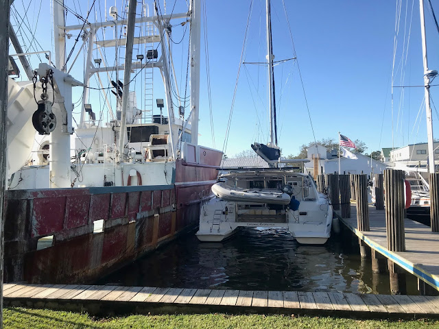
The marina is in good shape and Intermezzo is in a very protected slip along a floating dock,  a safe home for the next couple of months.

Tomorrow's bigger jobs are defrosting the freezer anbd washing the decks and hulls, plus a myriad of smaller tasks.

I fly back to California on Monday.

Entrance to Skull Creek at the north end of Hilton Head Island, Port Royal Sound


Wednesday, November 18, 2020

Charleston to Beaufort SC, Details of the Waterways

I thought it might be interesting for me to describe in some detail the route between Charleston and Beaufort that weaves through the waterways. For me, navigating these inland channels is like hiking through varied terrain on land.

Our journey begins in Charleston Harbor where we cross the Ashley River to enter Wapoo Creek. We cross under the fixed James Island Expressway Bridge and make our way as slowly as we can towards the Wapoo Creek Highway Bridge so as to arrive for its first scheduled hourly opening of the day at 9:30. Wapoo Creek is highly developed, lined with nice homes and private docks, fairly busy with small boat traffic even on a weekday morning.

We arrive much too early, contact the bridge tender on VHF Channel 09 to let her know we're waitng and provide our boat name and home port, and then kill time by slowly motoring back the way we came, turning around and slowly motoring back. The bridge finally opens, a swing bridge where the moveable span rotates on a central pier to open up a gap for us to pass through. We let the bridge tender know we're clear, thank her and wish her a good day. She wishes us well in reply.

We continue along Wapoo Creek for about a mile to enter Elliot Cut, which leads us to the Stono River. Cuts are channels dredged to connect two adjoining waterways. We'll go through several more today.

Stono River is huge compared to Wapoo Creek, a quarter mile wide of water with a half mile of flat marshland on either side making it appear even wider. The current is running strong in the direction we want to go, the cold wind blowing against it and us, producing a light surface chop. The water is brown, the color of cola with a hint of reflected blue sky. We start off heading north, then turn west as we round the top of Johns Island, the river gradually narrowing as we go upstream, yet the marshland on either side continue to create a sense of spaciousness. We're concerned about clearance under the John F. Limehouse Bridge as it's high tide, but the air draft boards tell us we have 66 feet of clearance, about two feet greater than expected, plenty of room.

We continue on for a couple of hours, gradually turning southwest to enter Wadmalaw Sound and then the Wadmalaw River, wider and deeper than the Stono. It's hard to figure out which is a main river and which is a tributary around here- tides dominate over river flows, the current flowing in both directions twice each day. Without aids to navigation, it would be hard to pick out the route of the main channel, easy to run aground in the many shoals and vast shallows. 

The Wadmalaw leads to the North Edisto River which ultimately empties into the Atlantic Ocean, but we turn off to continue westward on the much smaller Dawho River. Here we cross under our third and last fixed bridge of the day, again with some concern as the cruising guide reports only 63 to 64 feet clearance at high tide, not the charted 65 feet. We figure on having 65 feet and are pleasantly surprised to see 66 feet showing on the boards.

We turn southwest again to leave the Dawho and enter Watts Cut, a canal that connects us to the South Edisto River. Now the current is against us but the wind is behind us, the water the color of coffee with milk as we motor southwards for an hour until we turn right into the narrow, short Fenwick Cut, a quarter mile long connector to the Ashepoo River. The currents are strong at the entrance and exit of the cut and we have to be cautious of the shoals at each end, not cutting any corners.

We turn right again as we leave Fenwick Cut to head northwest on the Ashepoo for about a mile to turn left and head southwest into an unnamed cut and then turn right to head northwest again for a short distance on Rock Creek and then turn into the Ashepoo Coosaw Cutoff.

The Ashepoo Coosaw Cutoff is the most nerve-wracking part of our journey. It's low tide by the time we get there, the cut is shallow and narrow. The chart notes "severe shoaling" and that the Corps of Engineers "has no future plans for dredging due to budget restrictions." It's a bit risky navigating at low tide but the lowest depths are charted at 5 feet, Intermezzo draws 4 feet and, worst case, we run aground on mud and wait for the incoming tide to float us off.

I watch the depth sounder closely, we have mostly 7 to 8 feet of water, but we run through patches where the display goes from 6.6 to 6 to 5.5 feet- at which point I slow the boat down to a crawl - 5 feet, 5.5, 6, 6.5 - and I gradually speed up as the depth increases until normal cruising speed with 8 feet. This slowing down and speeding up, always trying to stay in the deep part of the channel, "feeling" my way along the sides, continues for a mile until the exit into the Coosaw River appears. As we leave the cutoff, the depth sounder shows 9 feet but then decreases quickly- 7, 6, 5, now 4.5 feet. I'm worried that we're not going to make it out and the river current is starting to push us sideways, I can't afford to slow down too much and lose steerage. I decide to put some way on, figuring that if I do touch bottom, I might plough my way through the soft mud into deeper water. The depth sounder shows 4.2 feet but we never bump bottom and the depth increases quickly afterwards as we enter the river channel and I breathe a sigh of relief.

Now we are heading west along the Coosaw, the widest of all of today's rivers. We're motoring into the wind and the current, the bright sun low in the late afternoon sky, producing sparkles and glare on the water surface. It's cold, blustery and I'm tired of navigating all the twists, turns, shoals and bridges. But we still have quite a few miles to go before we turn into the Bull River and then another two miles to the mouth of Wimbee Creek where we will anchor for the night. Fortunately, all the remaining water to travel is wide, deep and the channel route obvious.

We drop anchor in Wimbee Creek, but the day's boating isn't quite over yet as the bottom of the creek is scrabbly with shells and rocks and the anchor bounces around a bit before setting. We back down hard on the anchor to make sure it's set, place a waypoint on the chartplotter so we can monitor our movements during the night. The wind is blowing pretty hard and the current will reverse itself during the night. 

Finally, the day is done, 49 twisty-turny, windy, chilly nautical miles traveled.

Time for a well-deserved rum drink.


Charleston to Beaufort SC

We weighed anchor in Dewees Creek on Sunday morning after waiting for the tide to recede. I had received a weather alert on my phone for coastal flooding the night before and was concerned that an above average high tide combined with flooding might prevent us from getting under the Isle of Palms fixed bridge on our way to Charleston. We ended up passing under the bridge with plenty of clearance but then had to wait for 40 minutes for the Ben Sawyer Swing Bridge to open on the hour. We had tried to delay our arrival by going slowly, but the strong current pushing us along foiled our plans.

Once in Charleston Harbor we headed to Charleston Harbor Marina where we squeezed into a tight pace along a dock between a huge sailing catamaran and sport fishing boat. The marina is across the river from the city but the marina advertised a free shuttle to and from town. We subsequently learned that the shuttle wasn't running due to COVID which left us in a relatively isolated location and having to pay for an Uber or water taxi to the city. 

Monday morning Lisa was on the phone with Charleston City Marina, where Intermezzo had spent time on the "Mega Dock last June through July. They told her that they had a space for us, so we slipped our dock lines and motored over to the other side of the city, within walking distance of historic Charleston. 

We walked around all day Monday and enjoyed a dinner on Poogan's Porch, sharing fried green tomatoes and shrimp and grits, which I followed up on with a slice of pecan pie and an Old Fashioned. The day was warm and sunny, the night walking back to the boat quite chilly as a cold front approached.

Yesterday we started making our way to Beaufort a route that wound through a series of canals, cuts and rivers which I'll write about separately. The day was clear, sunny and chilly with a strong breeze from the northwest. It was a long ride, almost 50 nm and I was pretty weary as we dropped anchor in Wimbee Creek, two miles northwest off the Coosaw River. It was a pretty sunset and we had a peaceful night at anchor.

This morning we continued on to Beaufort and I was happy to be able to sail almost all the way here, the strong northwesterly breeze fill the jib and a fair current providing a nice boost to our speed. It was another bright, clear, sunny day, but cold.

Much of our route was adjacent to a Marine Corps Air Station with fighter planes were taking off, landing and wheeling about overhead.  "Restricted Area - No Entry" signs lined the riverbank at frequent, regular intervals. I saw two perfectly matched bald eagles on top of the posts for one of these signs facing each other, perfectly symmetric, mirror images of each other. So perfect I took themto be patriotic ornaments adorning the sign and thought, "Wow, the Marine Corps did a good job at making those eagles look real." Then they both took off flying. They certainly are handsome birds.

We pulled into Lady's Island Marina just across the Beaufort River from town early this afternoon and spent the rest of the day and into the evening walking around this beautiful historic small Southern city. It is like a smaller version of Charleston with grand old homes, but with many more trees, draped with Spanish moss. 

In case you didn't know, there are two Beauforts, one in North Caroline, the other in South Carolina .The northern one is pronounced "bow-fort", the southern one "bew-fort". Both are nice, but the South Carolina Beaufort is now my favorite by far. More history, well-preserved architecture, majestic shade trees, delicious food and a lot of craft beers, all surrounded by low-country waterways and marshland.

We'll spend tomorrow here and then we're off to Hilton Head, the end point of this journey from Montauk NY where Lisa ends her tour of duty on Intermezzo and I head back to California for the holidays.

As we were heading to our anchorage yesterday afternoon, a call came over the VHF radio reporting an overturned shrimp fishing boat. The boat had been overdue returning to port and a friend had gone out looking for them. The two fishermen from the boat were nowhere to be found and the Coast Guard launched a major search and rescue effort. It was late in the afternoon, cold and windy and we feared the worst, hoped for the best. This morning the search was still on and I didn't think there was much hope left after such a cold, windy night. However later in the day, one of the fishermen was found clinging to a liferaft and was rescued in stable condition. The search continues for his partner. I hope they find him. After spending so much time on the water, it is too easy for me to imagine the horror of being lost at sea, wet, cold and alone.

Sunset on Wimbee Creek

Saturday, November 14, 2020

Dewees Creek: Not What I Planned, Turned Out Better

Well, I planned to sail from Georgetown to Charleston on the outside. The winds were blowing from the northeast to give us a nice downwind ride, mild waves, nice sunny weather. It would have been a 12-14 hour passage, port-to-port, meaning we would arrive in Charleston Harbor after dark. No problem, it's an easy entrance, lots of aids to navigation and I've done it before.

Only there was no space in any of the marinas, being still filled with boats that sheltered from Hurricane Eta. And I don't like arriving at an anchorage in the dark. And Charleston only has a few places to anchor and none of them are good.

So, I decided to make our way to Charleston on the inside along the Intracoastal Watererway. I wasn't too happy about this, anticipating shoals, foul currents, bridges, power boat traffic and nothing much to see. Turned out I was wrong on all counts.

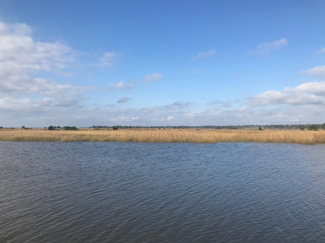
It was a beautiful day, mostly sunny with some sheets of white-grey clouds covering portions of the sky. The brown water had a touch of blue reflecting on its surface. Golden reeds stretched for miles, broken up by small creeks in a vast estuary with dark pines off in the distance. We saw several bald eagles, many other waterfowl and a few pods of dolphins. Quite beautiful.

The shoals reported on the charts and cruising guide were not difficult to navigate. We had a fair current most of the way, along one stretch we loped along at over 9 knots! We averaged almost 7 knots for the day. running on one engine almost the whole way. There were only a few powerboats, all of passed courteously at slow speed.  We only had to pass through one bridge, a private swing bridge that is left in the open position except when a vehicle needs to cross the waterway. 

Plus, we saved a night's docking fee by anchoring out rather than pulling into a Charleston marina, if space had been available. Oh, and Lisa didn't get seasick like she would have on the ocean.

So, it turned out much better than my original plan.

We're anchored in Dewees Creek, a wide deep creek surrounded by marsh grass. The tidal current runs fast here, it will switch directions around 22:00 tonight and hopefully our anchor will set quickly in the opposite direction when it does. It's quiet and calm.

Tomorrow we'll head into Charleston Harbor to a marina where a space will open up for us.

South Carolina Low Country Along the Intracoastal Waterway


Thursday, November 12, 2020

Georgetown SC: Rain, River Flooding and Hurricane Eta

We made it under the nine fixed bridges yesterday along the 24 nm of waterway between the Myrtle Beach Yacht Club and Osprey Marina. My vertical clearance calculations were spot on, except for the last bridge where the clearance per the air draft board was only 64 feet versus my estimate of 64.5. However, since the VHF antenna never touched, I think my calculation was the more accurate figure.

We also passed through three swing bridges, the first two without incident, the third requiring us to anchor in the channel for almost an hour to wait for a new bulb to be installed in one of the bridge's traffic lights. There was quite a line of boats behind us by the time the light was fixed and the bridge opened.

We spent the night in the Osprey Marina, a nice facility in a somewhat remote area between Bucksport and Myrtle Beach, a quarter mile down a private side channel off the main waterway. Our dock was so far away from the marina building that we were assigned a golf cart to get to and fro! We also received a welcome bag full of goodies and marina swag, a first for me.

It rained really hard last night, weather from Hurricane Eta making it's way north. Really hard. I haven't experienced a torrential downpour like that since being in Panama. And it rained heavily for a long time, too.

When we left the marina this morning, it was high tide and the waterway looked swollen by rain to me. We had only one fixed bridge to clear near the end of our day's journey, but I was worried that the rain would raise the water surface above the normal conditions on which the tide predictions are based. Also, the bridge was reported to have no air draft boards, so I would not have any actual clearance data when I got there, I would have to go by calculation and general observation.

We entered the Waccamaw River about a mile downstream of the marina. The Waccamaw is reported to among the most favorite rivers in the country for boating and I could see on a sunny day how beautiful it might be, a wide channel lined with broad expanses of cypress wetlands, surely teeming with wildlife. Today, though, it was grey, rainy and generally dreary, with little to see, all the colors muted and drab, all the birds and animals taking shelter.

I couldn't tell if the river looked so full and high just because it was high tide or if there were also a flood flow. I tried finding information about the current river conditions on the internet and learned that the upper reach of the Waccamaw is expected to crest at near flood stage late tonight. That concerned me.

I decided I would drive the boat over spot depth soundings shown on the chart and see how they compared to observed depth as measured by the depth sounder. A half dozen observations later, I concluded that the observed depths were very close to what they should be considering the state of the tide and that the rainfall was not raising the water surface. This was encouraging.

I had timed our arrival at the bridge to coincide with low tide to give us maximum vertical clearance. As we drew closer to the bridge I noticed that the roots at the bases of the cypress trees were exposed and that the water surface was several feet below the high water line on the day mark poles. Also good news.

"Community Notes" on my electronic charts stated that the bridge has 65 feet clearance if the water is just a few inches below the top edge of the fifth board down from the top of the bridge fender. I needed to observe the water to be at or below the top of the fifth board before I would try passing under the bridge. As I got within range to observe the bridge fenders with the binoculars, it started to rain really hard, obscuring any visibility. A strong current was pushing us towards the bridge and, though I knew the engines were powerful enough to overcome it should I need to turn around, it was still a bit nerve-wracking, moving quickly towards the unknown in driving sheets of blinding rain.

Fortunately the rain eased and I was able to make out the bridge fender boards at last. One, two, three, four, five...six boards showing. Whew, what a relief, something slightly more than 66 feet clearance! A bit less than what it should have theoretically been at low tide, so maybe there was a bit of rainfall effect on the river. I proceeded under the bridge, slowly and cautiously at first, then at normal speed as I confirmed we had plenty of room above the mast. What a relief! I celebrated my piloting and navigation victory with a wee dram of rum.

We pulled into the anchorage in front of the steel mill in Georgetown at about 14:00. Quite a few boats are anchored here, so we had be a bit careful about where we chose to drop the hook. The anchor didn't set on the first drop, which hardly ever happens, but I attributed it to the shallow 6.5 foot depth and short chain length even at a 5:1 scope. We dropped again and backed down long and hard with the engines to make sure the anchor was set, then finally got out of the rain and relaxed for the rest of the afternoon. 

The day's drama was not over, though.

Since we have been sailing inland waters, I have been following the land weather forecasts more closely than the marine ones. The land forecasts make only passing reference to Hurricane Zeta and only in terms of rainfall. The marine forecasts mention the hurricane incidentally in the synopsis, but nothing of special note. And I stopped checking the National Hurricane Center reports when I read that Zeta was heading into the Gulf of Mexico. That was a mistake.

The hurricane just passed right by us not far offshore from the coast!

Around 19:00 this evening, the wind started blowing really hard, mid-20's to 30 knots. A boat downwind of us flashed a light at us and yelled across the water, "Are you dragging?" It was difficult for me to fix our position in the darkness. I didn't think we had dragged anchor because our position relative to the boat to our port was about the same. However, it looked like we might have moved relative to the three other boats nearby. I switched on the chartplotter and, lo and behold, we had dragged about 400 feet! The first time Intermezzo's Rocna anchor has ever dragged and quite a surprise to me, given how hard we backed down on it when we dropped. The boat next to us was dragging, too, thus my initial confusion.

We fired up the engines and Lisa did a fantastic job driving the boat in 30-plus knot winds and driving rain while I handled the ground tackle up on the bow. We motored back close to where we originally anchored and dropped the Rocna again, this time with an additional 25 feet of chain, 100 feet total in 10 feet of water.

I set an anchor drag alarm and placed a waypoint at the boat's location on the chartplotter so I could monitor our movements. We seemed to be set pretty well, but we did trip the drag alarm once, our position shifting by about 90 feet downwind. The wind is veering us around quite a bit and I'm thinking that the anchor is getting tripped up a bit in the shallow water as we move from side-to-side. We haven't moved since, so I'm hoping that the anchor has dug itself into the hard mud bottom for the night.

Fortunately, I can monitor all this from inside the comfort of the cabin with my iPad repeating the chartplotter display at the helm. I'll be sleeping in the salon tonight so that I can keep watch and hear the drag alarm if it goes off. The winds are supposed to drop a lot as the hurricane has passed by, so I'm not too worried. It won't be a night of uninterrupted sleep, though.

Frankly, I'm tired of these Atlantic coast hurricanes and fronts. So much more frequent and volatile than what I'm used to in the Pacific.


Tuesday, November 10, 2020

Little River SC, Tides and Bridges

We made it under the Snow's Cut Bridge yesterday morning with plenty of room to spare above the mast. The air clearance board at the bridge fender showed 67 feet clear, which matched my own tidal calculations to within about a tenth of a foot. Just to be sure, we let the catamaran ahead of us with a similar mast height go through first.

I now believe I have a pretty good understanding and methodology for navigating bridges on the the Intracoastal Waterway (ICW). That's a good thing, as we have dozens of bridges to pass through or under ahead of us.

The trick is to know both the tidal height at the time we pass under the bridge and the Mean High Water (MHW) level at the bridge. Almost all of the fixed bridges along the ICW have a minimum clearance above MHW of 65 feet. Intermezzo needs 64 feet to pass with a degree of comfort, just the top six inches of the VHF bending when it touches the bottom of the bridge girders with that clearance. So, if a bridge has a charted minimum vertical clearance of 65 feet and the tide is less than one foot above the MHW, we are good to go. I can lookup the MHW for any tide station at NOAA's website and my electronic charts give me the predicted tides at any time during the day. Voilá!

So, the reason we couldn't pass under the Snow's Cut Bridge on Sunday afternoon was because the high tide was almost 2 feet more than the MHW at the bridge, resulting in only 63 feet of vertical clearance, a height at which the mast would clear structurally, but rip off or damage all the appurtenances above its top.

After clearing Snow's Cut, we proceeded down the Cape Fear River towards Southport under overcast skies with occasional rain showers. At Southport we turned west into the dredged canal that we would follow for the rest of the day, interrupted only by more natural, meandering channels in the vicinity of ocean inlets. As we passed the Southport Marina where we stayed for a few days last July, we observed the aftermath of the damage caused by hurricane Isaisis, which we waited out in Martha's Vineyard in August. I'd seen photos of the destruction caused to the marina's docks and boats piled up on one another along the sea wall. Now, all the docks are gone! The marina is just a big open basin with nothing in it, only a fuel dock operating. I saw construction equipment, too, so I'm sure they are beginning the rebuilding process after removing all the damaged structures and vessels.

As we approached each of the bridges crossing our route, I would do a calculation on the fly to estimate the vertical clearance and then, when a faster boat passed us, called them on the radio and asked them to report back the height shown on the air draft boards at the bridge when they go there. That worked great, my calculations again being within a few tenths of a foot of actual. We passed under the last bridge with a clearance of 64 feet, our antenna scraping the underside of the bridge. The only thing I worried about was a passing boat's wake, which might cause us to rise and bump the mast top hard. Fortunately, the power boaters seemed aware of this and slowed down to let us pass by ourselves with flat water.

We docked at the Myrtle Beach Yacht Club just before 3 pm yesterday, a nice marina, good facilities, reasonably priced. 

The weather yesterday was very warm, a high temperature of 80 degrees F. Shorts, t-shirt and bare feet weather- Lisa is loving it. It's going to be sunny and warm today, too. Then it's rain for almost a week straight, the aftermath of yet another hurricane, Eta. So we're staying put today to do a land excursion in the nice weather, save the dreary days for moving the boat along.

The next stretch of the ICW goes through a stretch called "The Rockpile", a dangerous portion of the narrow canal where, according to the chart, "numerous rock ledges have been reported abutting the deep portion of the ICW channel. Mariners should use extreme caution to avoid grounding in this area." Commercial vessels use this channel which is too narrow between the rock ledges to allow vessels to pass. The commercial vessels reportedly announce themselves on the radio and wait in wider spots for recreational vessels to pass through before proceeding. I hope that is indeed the case.

We also have over a dozen bridges to negotiate on the next leg, so my tide calculations will be frequent and numerous. My preliminary figures indicate no problems, but I am concerned about the effect of rain on the water levels, which is not taken into account by tide stations. I believe I can get some hydrograph data from the Corps of Engineers if it rains hard enough to really worry me. I may be consulting with Rick Jorgenson, a good friend and engineering colleague who is an expert in hydrology, should the need arise!

What do non-engineers do to amuse themselves on the ICW?

Lisa watching the catamaran ahead of us clear the Snow's Cut Bridge

The Snow Cut Bridge air draft board (near lower center of photo) showing 67 feet clearance, close to my tidal calculations

The ICW west of Southport

A fishing vessel that didn't fare well near Lockwoods Folly Inlet


Sunday, November 8, 2020

Carolina Beach, Stopped By a Bridge

Last night we made an "outside" passage along the Atlantic coast from Cape Lookout to Mansboro Inlet. We had good winds but messy seas, making for an arduous trip. It was a relief to enter the inlet and get back on the calm but busy Intracoastal Waterway (ICW) until our progress was stopped by a bridge-too-low (or, rather, water too high).

First, a quick recap of Intermezzo's progress and our activities since stopping in New Bern four days ago, on Wednesday.

On Thursday we departed New Bern and motored back down the Neuse River on a beautiful sunny day to rejoin the ICW at Adams Creek. We anchored for the night in a quiet little spot off the main channel, very close to where we anchored last July.

Friday we headed to Cape Lookout Bight, stopping briefly in Beaufort NC to top up with diesel. We had very limited internet access along the way, which added frustration to the suspense of the presidential election results.

Cape Lookout Bight is one of my favorite anchorages, perhaps my most favorite, between Key West FL and Mattituck NY. When we were here last July, we were the only boat anchored or one of just a couple. This time there were a dozen or so boats, mostly sail boats with masts too tall for ICW bridges. After we dropped anchor, we took the dinghy to shore and had a good long run out and a walk back along the mostly deserted beach. It was breezy, the evening light made gloomy by low clouds, but the temperature was pleasant and even the water was not that cold. 

Yesterday (Saturday), after doing some morning boat chores, we took the dinghy to the old lighthouse on the eastern shore of the bight, walked around a bit and then relaxed on the beach for a while in warm sunshine.

We left Cape Lookout last night at 22:00, raising the sails in the calm waters of the bight. The seas became much more boisterous as we came out the inlet and turned southwest. We had a nice 15 knot wind behind us, but the swells coming from the east were 4-6 feet with a period of about eight seconds, making for a very uncomfortable ride, though they were following seas. Intermezzo would just get over the crest and through the trough of one wave only to immediately climb and fall down another. There was also a secondary swell coming from the north east that made for a confused sea state. 

Lisa was badly seasick, but managed to stand her three hour watch. I sailed the rest of the 13 hour passage single-handed. Apart from the crappy waves, everything else was quite nice, the sky clear with lots of stars and a half-moon shining most of the night. I was warm in my foulies and a light fleece base layer. We were even visited by a pod of playful dolphins, the first time for a long while. The dolphins we saw in New England seemed standoffish, busy fishing I guess, no time to play and socialize. 

I was a bit worried about entering the Masonboro Inlet with such heavy seas running. I needn't have been. The inlet is deep, well marked and protected by long massive rock jetties on either side. It would have been an easy entry except for the two large motor  yachts that barreled close past me, throwing up giant wakes that combined with the rough seas to make for a bouncy ride and requiring a lot of attention at the helm. So many of the captains of these yachts are intoxicated by horsepower, very impolite.

Once inside the inlet, we turned left and got back on the ICW. The wind was strong enough and from a good direction, so I was able to sail under the jib along the narrow channel with marsh and beach on the ocean side, houses with private docks on the land side. I liked that we sailed almost all the way from Cape Lookout, hardly burned any diesel at all. 

At Carolina Beach, the ICW turns right into Snow Cut, which leads to the Cape Fear River. The Snow Cut (Carolina Beach) Bridge spans across this cut, the first ICW bridge we passed under on the way north. A strong current was pushing us along towards the bridge which meant a rising tide. I peered at the base of the bridge with the binoculars and found the board showing the bridge clearance from the water surface - 63 feet. Not enough! The mast would make it through, but we'd likely damage the VHF antenna and perhaps even the wind indicator.

I turned Intermezzo around quickly and motored into the current and back to the ICW channel. I saw a nice long fuel dock across the way and decided to pull alongside to wait for the tide to fall and give us more clearance. However, when I looked at the tide tables, I realized it would be too late in the day for us to make it to a marina or place to anchor after getting under the bridge so I decided to stay where we are for the night. Low tide is around 09:00 tomorrow morning and that should give us nearly 67 feet of clearance, more than enough. Then we'll have a long day, having to cover 45 miles to get to our next stopping place.

I think I prefer the open ocean, even with crappy waves, over this stretch of the ICW, a narrow, constrained, busy water roadway. 

The Snow Cut Bridge, a bridge too low


Wednesday, November 4, 2020

New Bern NC, Detour for Sea Ray's

 Short post today.

We biked around Oriental this morning then enjoyed an easy motor up the Neuse River on a warm, sunny afternoon to New Bern.

New Bern was a favorite stop on the trip north and crew change location. It's about a 21 nm diversion each way off the Intracoastal Waterway (ICW). We did it mostly to have dinner at Sea Ray's Cafe. Big plates of fried soft-shell crab, scallops, clams and fried okra. Very Southern. Very filling. Not so healthy, but tastes good.

Back to the ICW tomorrow to start making some serious miles for a few days. Looking at going "outside" on the ocean between Beaufort and Wrightsville Beach NC. The weather's looking good and it would give us a chance to visit Cape Lookout Bight, a really nice remote spot.

Intermezzo's wake on the calm surface of the Neuse River


Tuesday, November 3, 2020

Oriental NC, A Favorite Stop

 We were up early today, clocks set back mean sunrise is now an hour earlier at 06:30. It was cold, but sunny and clear with a breeze from the WNW.

We motored west against the wind until the Pungo River turns south where we raised sails and enjoyed a nice reach down the Pungo and across the Pamlico River. We dropped sails as we approached the south shore of the Pamlico and turned west and upwind to enter Goose Creek and continue southward.

Lots of boats are making their way south on the Intracoastal Waterway (ICW). I find amusing how they often get close to each other as they follow "the magenta line", a line on the chart that denotes the ICW's route, even when there is plenty of sea room on either side of the line. They negotiate over the radio to pass one another as if on a narrow country lane. This is helpful in a narrow river or canal, but is pretty ridiculous when there is a mile of deep water on either side of the line. Amusing.

Goose Creek does get pretty narrow but then leads into the Bay River which then merges in to the Neuse River, where we turned west again and followed the north shore to the channel leading into the town of Oriental. Oriental was one our favorite stops on the way north and it's nice to be able to visit again.

We docked at the free town dock, at first pulling next to a huge steel fishing boat, a very tight fit between docks. Then I inspected the fishing boat's dock lines and concluded that if any wind significant wind at all came from the east, Intermezzo could be crushed like an egg. So, we moved to the other side of the town dock to be safe.

We took a walk this afternoon and had a snack at Bartley's, whose owner did us a good turn last summer.

It was really hot when we were here last July. It's quite cold now and no electricity on the dock means nbo heat on the boat.

Too close for comfort


Sunday, November 1, 2020

Low Bridge, Low Water

I forgot to write about our experience passing under the Wilkinson Bridge as we made our way through the Alligator River-Pungo River Canal yesterday.

All the fixed bridges on the Intracoastal Waterway (ICW) have a minimum clearance of 65 ft at mean high water per Army Corps of Engineers specifications. Somehow the Wilkinson Bridge was constructed with a clearance of only 64 feet.

The top of Intermezzo's mast is 62 feet 8 inches above the waterline. The VHF radio antenna extends 18 inches above the top of the mast, which puts its tip at 64 feet 2 inches above the waterline. The water level gauge at the base of the bridge read barely 64 feet clearance. Sure enough, as we passed under the bridge- very, very slowly- the antenna bent as it brushed the underside of the bridge girders. 

I've never been that close before. I hope never to be so again.

Now we have a low water issue.

The high winds blowing from the northwest tonight are sucking the water out of the Pungo River and surrounding sounds. There is a low water advisory (something I've never heard of until now) as water depths are expected to fall far below normal in these non-tidal bodies of water. 

The marina reported that during the last storm like this, the depth of the water at the docks fell 2-3 feet. This storm is supposed to be worse.

The depth sounder showed 5.3 feet deep water where Intermezzo was originally tied up to the dock. We start touching bottom when the depth sounder reads 4.1 feet. So, if the water depth fell 3 feet during the storm, we would be sitting on the bottom. We moved the boat further up the dock where the depth sounder read 7.1 feet for a better chance of staying afloat. So far the water has fallen about six inches.

The bottom is soft and level, so it's not that big a deal if we end up aground. I just have to be aware of what's going on with the docklines and all is clear for when we re-float.

Sometimes the water is too high, sometimes it  is too low, sometimes it is just right.

Saturday, October 31, 2020

Bellhaven NC, Weather Cautious

Intermezzo is tied along a dock at Dowry Creek Marina near the town of Bellhaven on the Pungo River. We're watching the weather forecast, which continues to call for stormy conditions and high winds tomorrow through Monday. I'd prefer to wait a couple days than endure unpleasantness.

We upped anchor just before 8 am this morning and headed down the Alligator River-Pungo River Canal. There were a few clouds in a blue sky, the air crisp-cool. The canal is quite narrow with wooded banks. The tallest trees are some sort of pine, the type with brush-like needles. Hardwood trees come up about half the height of the pines, shrubs and saplings filling in the base of the forest. The water's edge is lined with grasses, dead trees, stumps and snags, the banks eroded from the wakes of fast-moving boats, the roots of the trees exposed, the trees sure to tip over in a strong hurricane. 

The water in the canal was perfectly flat; what a contrast to yesterday's waves. Up ahead, the surface was a silver reflection of the sky, to the sides the water ink-black in the shade of the trees. The morning light cast lovely shadows in the foliage and a moving shadow of Intermezzo's mast. A very pretty and relaxing scene.

We left the canal and entered the Pungo River and turned into the marina shortly thereafter, our 29 nm day's travel passing quickly. We docked the boat and then borrowed the marina's courtesy car to visit the nearby town of Bellhaven. 

The Waterway Guide describes Bellhaven as a place "where you will find most of what you need. Many of the the businesses, sops, restaurants and the museum are within a short stroll from the town dock. Victorian homes sit along many of Bellhaven's tree-lined residential streets..."

Sounds nice, right? Well, I'm sorry to say that my impression of Bellhaven is of a poorly planned, terribly executed town in decay. I have rarely seen such horrible architecture, poor landscaping and quality of construction in the U.S. There are a few nice old homes sprinkled around town, but most of the buildings are in poor repair and the town was deserted on a Saturday. The people seem nice and there seems a sincere effort to attract and welcome tourists, but, boy, does this place need help. Perhaps in the summer, perhaps without COVID, it is a brighter place, but it was dreary and depressing for us.

Unless the weather looks better, we'll hang out at the marina and get some chores done until Tuesday.

Sunset at city dock in Columbia NC
Full moon over the Alligator River 


Entering the Alligator River-Pungo River Canal
Bank of the Alligator River-Pungo River Canal

Friday, October 30, 2020

Alligator River, a Windy Day

It was a windy day.

We had to use a bow spring to get off the dock in Columbia NC this morning, the wind pressing Intermezzo's hull hard against the dock face.

We bashed through steep head-on chop as we headed out the mouth of the Scuppernong River into the Albemarle Sound, 25 knots of NW wind on the nose, the bows crashing through the waves, water washing down each side deck.The sky was mostly cloudy, the water grey flecked with whitecaps everywhere, ominous looking.

At the last day marker, I turned Intermezzo northeast, now the steep closely spaced waves hitting us broadside, rolling the boat violently from side to side. The strong beam-to wind blew spray across the boat as the engines throbbed us along at a steady 6-7 knots. The clouds diminished enough to let some sun shine on us, but I got cold and had to pull on another layer of fleece under my foul weather gear.

Once clear of a shoal the extends out from the shore about 8 nm from the river, I could adjust our course more eastward and now we could take the waves off the port quarter, quite a bit more comfortable, but still some rolling and wind blown spray. It would have been nice to have piloted Intermezzo remotely from inside the salon, but there were too many crab pot buoys to make that possible; I could only see them if I was sitting outside at the helm.

I followed the shoreline as it curved southward towards the mouth of the Alligator River, gradually putting the waves behind us and unrolling about half the jib to help move us along more quickly. I wanted to be out of the Albemarle as quickly as possible. The ride became more comfortable and Intermezzo surfed down the waves, hitting a maximum speed of 12.9 knots.

I was a bit nervous as I rolled in the jib and approached the Alligator River entry, wondering if the river bar was shallow enough to cause the waves to mount up and break. Fortunately, that was not the case and I followed the day markers into the river channel, the waves now quartering us to starboard.

We motored to the Alligator River swing bridge, which opened with perfect timing to let us pass through without having to loiter. Once through the bridge, I unrolled the jib to its second rolling reef position and turned off the engines to enjoy a fast downwind romp down the Alligator River. I took a few more turns in the jib when the winds blew a steady 30-35 knots for about an hour. With just the reefed jib, we made a steady 6-7 knots southward under partly cloudy skies, temperature still cool even though we were sailing downwind and the sun was shining most of the time.

The Alligator River is about three miles wide from its mouth at the Albermarle south until it turns sharply to the west and narrows from less than a mile to become a winding creek to its head. The banks are lined with scrubby timber and marsh vegetation. It's not a particularly scenic river, but I like its remoteness.

As I made the right turn to follow the river, I started the engines and rolled in the jib as we pointed upwind. I diverted from the Intracoastal Waterway (ICW) channel at the entry to the Alligator River-Pungo River Canal and headed about a mile and a half further up the Alligator where we dropped anchor. It was windy, blowing over 20 knots, but the waves were very small, more like big ripples, quite comfortable.

After the sun set, the wind dropped to five knots and we are lying nicely at anchor under a bright white full moon.

We were never in any danger today, the wind strong and the waves steep and nasty but nothing to be of any concern to an ocean-going boat like Intermezzo. Still, I am tense and alert the whole time sailing in such conditions and, together with the constant blast of the wind all day, it is very tiring. I had had enough sailing for the day when we dropped anchor, thank you very much.

The forecast is for lighter winds until Sunday night, into Monday, when another cold front passes through. We'll sit that one out in Bellhaven. It's also going to get colder. Don't tell Lisa, but I saw forecast data that suggest near freezing temperatures. Brrrr…

Thursday, October 29, 2020

Columbia NC, SItting Out a Severe Storm Alert

Intermezzo arrived at the city docks in Columbia NC around 13:30 this afternoon after a very windy passage from the mouth of the New River across the Albermarle Sound. We're safe and sound, it's very warm out (82 degrees F, "feels like" 90 according to weather app!) and we are being regularly blasted by gusts greater than 40 knots. We have double dock lines out and there are no land objects (like trees or wires) close by to fall on us. So all is good.

We left Broad Creek this morning at dawn and I motored at maximum cruising speed the whole way here. Intermezzo's little Yanmar engines did great, maintaining over 7 knots until the headwinds got to 30 knots, then speed only dropping to 6.8 knots. My strategy was to get across the sound and to a sheltered spot before the forecasted gale-force winds started blowing in the afternoon.

I took Intermezzo on a direct route across the sound until I was close to the southern shore then I turned west towards the entry of the Scuppernong River. By sticking close to shore, the waves didn't have much fetch and so we motored against only a light chop the whole way, despite the high winds. It was a breezy 15 nm motor into the wind to the mouth of the river, the apparent wind speed often over 30 knots and I saw several 40+ gusts.

As we turned into the river, a distress call came over the radio for a boat in trouble in nearby Bull Bay. The Coast Guard hailed us to request we look for the vessel, so we turned around and headed back out. Despite scanning the area with the binoculars while navigating windy shallow waters, we saw only one boat and it didn't look like it was in distress. We provided information to the Coast Guard and then turned back on our course upriver. Later we heard over the radio that the vessel in distress had been located and received assistance from a USCG small boat.

My hope was that the Columbia city dock would have space for Intermezzo, but I managed my expectations as there are many vessels heading south on the Intracoastal Waterway (ICW) this time of year and I imagined at least several had the same idea as I for sheltering from this storm. How happy we were to find the dock completely empty! It was a bit tricky coming alongside with the wind gusting, but the blows were coming from a favorable direction so I was able to make a very smooth landing.

There is a severe storm risk alert here from 12:30 today until 08:00 tomorrow. I don't understand all the meteorological gobbly-gook, but am intrigued by the statement, "Thus, only (italics mine) isolated damaging convective gusts and/or a brief tornado may occur prior to 21z (21:00 GMT or 17:00 local)." What a relief? I make out that the 40 knot gusts will continue but no sustained damaging winds are expected.

We'll hole up here at least until tomorrow, depending on how the post-storm forecast develops.

Wednesday, October 28, 2020

Broad Creek NC, Here Comes Zeta

We left Blackwater Creek this morning around nine a.m., later than I wanted to but we had to wait for the tide to rise to give us enough depth to cross the shoal at the creek's entrance. We continued south along the North Landing River under mostly cloudy skies, the sun sometimes peeking out to shine sparkles on the water. The river widened to a become two miles wide of shallow water with a narrow channel dredged through it, our path along the Intracoastal Waterway (ICW).

The river ended at the North Carolina Cut, a narrow manmade channel where we crossed the Virginia border. The cut led us into the North River which began as a sinuous channel about a half-mile wide and then became a wide expanse of water, like a sound. The day had turned sunny and warm, with a consistent 10 knot wind out of the southwest.

We diverted from the ICW channel to the west bank of the river, navigating through consistent nine foot depths to the mouth of Broad Creek. We ventured a short way up the creek to a wide spot with a nice pool of 10-foot deep water and dropped anchor for the night.  This spot is similar to last night's anchorage, though with a few more trees and greater variety of marsh grasses and plants. We enjoyed some downtime on the lanai until we were chased inside by hungry mosquitos which appeared just after sunset. I had hoped it was late enough in the season to be too cold for mosquitos, but was out of luck. I feel a bit like Goldilocks, too hot, too cold, seldom just right.

And now here comes Hurricane Zeta, which is forecast to bring us high winds with gusts up to 30 knots tomorrow afternoon. This changes our planned route. Instead of turning left and sailing down on the inside of the Outer Banks, we'll cross the Albemarle Sound tomorrow morning and find a secure berth in Colombia, NC on the Scuppernong River. The hurricane's winds will be with us for several days, as they clock around from the south to the north. It looks like we'll have to stay put Thursday afternoon and Friday, be able to travel on Saturday and Sunday and then have to hole up again for Monday.

We are at ICW Mile Marker (MM) 60 (statute miles). Hilton Head is at MM 560. We have a long way to go and about three weeks to get there. This weather delay doesn't help and means we'll likely miss visiting Ocracoke, one of my favorite stops on the way north.


Sunset at anchor in Broad Creek
Approaching the North Carolina Cut


House along the North Carolina Cut


Intermezzo's anchorage in Broad Creek

Tuesday, October 27, 2020

Blackwater Creek, Along the Virginia Cut

We resumed our journey south this morning after a few days in Portsmouth VA during which I made a surprise birthday visit to my mom who lives in Loudon County, a three-and-a-half hour drive away. It was great to see her, my brother Phil, his wife Pam and their new dog Mia.

We left the marina just before eight a.m. in dense fog, barely able to see the opposite bank of the Elizabeth River a quarter-mile away. We took the southern branch of the Elizabeth to join the Albermarle and Chesapeake Canal about 10 miles south, known as the Virginia Cut route. The fog cleared to a grey overcast sky that persisted all day. Along the way we passed under or through seven bridges and stopped to top off with diesel. The diesel was the cheapest I have ever purchased at $1.89 per gallon.

On the way north last year, we took the Dismal Swamp route along the Intracoastal Waterway (ICW). I decided to take the Virginia Cut this time to see what it is like and because it brings us closer to the route I want to sail on the inside of the outer banks of North Carolina.

We entered the Albermarle and Chesapeake canal through the Great Bridge Lock. The lock is very long and wide and can accommodate dozens of pleasure boats, raising or lowering them just a couple of feet. We shared the lock with only one other boat, tied along the south side of the lock against a really nice rubber rendering system. We barely noticed when the water rose in the lock and then the gates opened and we were on our way.

We continued along the canal, with wide expanses of scrubby woodlands and marsh to either side. We didn’t see much in the way of wildlife or waterfowl, though we were treated to a close sighting of a bald eagle which flew over the boat to perch on a tree and preen itself.

We navigated through another five bridges. A couple of the bridges are fixed with the 65-foot minimum ICW vertical clearance, which is a tight fit for Intermezzo’s mast. The opening railroad bridges are normally left in the open position, but the highway bridges only open on the hour and half-hour, so we had to hover and wait 10-15 minutes a couple of times to get through. This will be what it will be like for us taking the “inside” route south for the next couple of weeks.

The south end of the canal joins the North Landing River which we continued along for about 9 miles to Pungo Ferry. Here we turned off the river into narrow, winding, shallow Blackwater Creek where we dropped anchor in a wide oxbow for the night. We could have continued further down the main river, but that would have required us to tie up (and pay) for the night in a marina.

We are nestled in a huge expanse of marsh grass, the air and water perfectly still. Fish sporadically pop above the surface with a small splash and occasionally a duck quacks. It’s very pretty and peaceful, though reminders of nearby civilization are ever-present, the dim sound of traffic, a dog barking, lights glowing off in the distance.  I’m glad to be here in the cooler weather as I can imagine the mosquitos and other insects could be fierce in the summertime. Funny how after complaining about cold weather I am now lauding it.

Fog lifting at the Glimerton Lift Bridge, with the Norfolk and Southern Railroad Bascule Bridge beyond


The Great Bridge Lock

Photos, Passage to Norfolk VA

 Just posting a couple of photos from Intermezzo's passage from Montauk Point NY to Norfolk VA.


Sunrise in Intermezzo's wake on the Atlantic Ocean

The USS Mitsher barreling through the channel past Intermezzoat 20 knots


Friday, October 23, 2020

Arrived Norfolk

Intermezzo is tied up to the dock at Tidewater Yacht Marina in Portsmouth VA, just across the river from Norfolk. We arrived  at 17:25 this evening, 58 hours after weighing anchor in Lake Montauk on Wednesday morning. We sailed (motored) a distance of 353 nm for an average speed of just over 6 knots.

After our foggy night, the sun rose this morning blotted out by thick overcast skies with patches of fog lingering. By noon, the sun was peeking out as we approached the entrance to Chesapeake Bay, the sea an olive green, the swells tightening up and becoming choppy in the more shallow water. 

As we entered the bay, I heard one side of a radio transmission between a US Navy warship and a research vessel. Warship to research vessel: "We are going to begin gunnery exercises in 30 minutes and are interested in your navigation intentions." I couldn't here the research vessel's reply, but if I were it's captain I would answer, "What my previous intentions were are now irrelevant. My intentions now are to navigate away from where you will be shooting, if you would be so kind as to share that information."

As we proceeded towards Norfolk, the sky cleared, the sun shone and it became another lovely day for shorts and no shoes.

As we crossed over the tunnel of the Chesapeake Bay Bridge-Tunnel, I had my own encounter with a Navy warship. The USS Mitsher, an Arleigh Burke class guided missile destroyer was barreling towards us at 20 knots. It was quite a site to see as the ship passed just a 100 yards on our starboard. 

Of course, such a large vessel traveling at such a speed in a narrow channel throws quite a wake behind it. I slowed the boat down and turned into the four foot high waves and, to my horror, remembered that I had opened the hatches to air out the boat. Oh no! I steered very carefully and fortunately was able to ride over the wake without shipping any water over the deck and into the boat. A much better result than my recent mishap with open hatches.

The last miles of the trip were uneventful as we passed by half a dozen aircraft carriers and a variety of warships at the Norfolk navy base in the warm sun.

We're pretty tired from the passage. I'll post a few pictures from the trip tomorrow.

Approaching Norfolk, Foggy Night

08:00 October 23, 2020
40 nm NE of Norfolk VA

Fog.

It was foggy last night. Hard to tell the visibility as the navigation lights were diffused by the mist so much that I couldn't see much past the bow of the boat from the helm station. From up on the bow, the forestay cast a shadow that told me visibility wasn't zero. When I turned off the nav lights and looked back at our luminous wake, I guess I could see about a quarter mile or so. I'd bet actual visibility was a mile or more. But what matters is how conditions appeared to us and to other vessels in the area.

So, we turned on the foghorn, set the radar to a short range and set the gain for maximum sensitivity, set an alarm to go off if AIS-equipped vessels got with a couple of miles. And we kept a very close watch, poking our heads out frequently into the gloom to listen for the sounds of other vessels. I donned foulies and gear for standing watches outside in the very moist, literally dripping, air. Lisa stood her watches inside, vigilantly staring at the radar display on the iPad for hours and waking me up if anything of concern appeared. We only had one non-AIS vessel to keep track of on the radar all night, so it was mostly staring at nothingness while I caught catnaps between going out to the helm station to maintain my "situational awareness" of not being able to see a thing and being covered by moisture from head to toe.

Thank goodness for modern navigation instruments. It would be very tricky to know our position without GPS and electronic charts, instead relying on dead reckoning and paper charts. It would take a lot of practice to get competent navigating that way, hats off to those who did so in the past and do so skillfully now. And without radar and AIS, nobody could "see" us, nor we them. Some may say it's become too easy, taken the challenge out of sailing, reduced sailors' skills. I appreciate the enhanced safety and relative simplicity of modern navigation, preferring to practice dead reckoning and celestial navigation as a hobby rather than a life-safety necessity.

The sun rose around 07:00, though we can't actually see the big star. It is overcast with patches of fog. The fog will go away as the air warms up. Not sure if the sun will shine, though. The swells from Hurricane Epsilon show up every so often in the form of 6 foot-plus long swells from the southeast. We passed a ship that had turned 180 degrees while we were watching it. I radioed them to find out why and the deck officer told me they were going back and forth, waiting for the hurricane to dissipate before heading out to sea towards Europe.

Not much further to go. Our current ETA to the Chesapeake Bay Entrance sea buoy is 13:08 this afternoon. It's about another hour or so to the Elizabeth River and our marina rest stop in Portsmouth VA for the next few days.

Thursday, October 22, 2020

En Route to Norfolk, Beautiful Day

18:30 October 22 2020
28 nm ENE of Ocean City, MD

What a beautiful day!

It was sunny, warm, light breeze and gentle long-period ocean swells. I wore shorts and was barefoot for most of the day! I took a shower outside off the stern. What a difference compared to the cold past few weeks.

My only complaint is not having enough wind to sail. The upside is we are turning 6 knots on one engine and will arrive in Norfolk tomorrow mid-afternoon, about eight hours ahead of my original estimate.

I tried fishing. The fish here must have sharp teeth. One lure lost its hook, tho other lure (expensive one) gone completely. Fish won today. They deserve it.

Feeling grateful for today.
A beautiful sunrise with pinks and purples in the sky and reflected on the thick oil-like surface of the water.
Sun and warm weather.
Good sleep.
Tea and cookies at 16:30, an emerging Intermezzo tradition.
Delicious fresh haddock dinner.

Looks like we'll miss the Hurricane Epsilon swells; the storm generating 42 ft waves as it passes Bermuda!

One more night and then we're on the home stretch.

En Route to Norfolk, Passing Atlantic City

Intermezzo is about 35 nm off the coast of New Jersey, passing by Atlantic City. It was a beautiful dawn and sunrise, pinks and purples reflecting on the thick oil-like water, a few wispy pink clouds up in the sky. Conditions are very calm, the wind is clocking northwards, as forecasted, but is very light. The boat is covered in dew and it's damp in the cabin. Hopefully, the sun stays out for a while and dries things out a bit.

Last night was calm and peaceful, cool but not cold. The night sky was clear, lots of stars, a few planets and the Milky Way visible, despite the glow from New York City on the western horizon. Hard to imagine, when you are alone on the ocean, just a few dozen miles away there are many millions of people living close together. The light, noise, bustle on land so different than the peaceful, quiet darkness on the water.

We set up an inside navigation station using the iPad to display the chart plotter and radar in the salon. It worked great. We had to dodge a couple of sport fishing boats heading out from New Jersey at high speed early this morning.

Crew and captain getting decent sleep, despite being short-handed.

Wednesday, October 21, 2020

En Route to Norfolk

21:30 October 21 2020
75nm SSW of Montauk Pt

Motoring steadily under clear starry skies towards a crescent moon. The moon lights a sparkling path on the undulating water surface ahead. Cool, almost chilly air with a 10 knot headwind that feels gentle, refreshing.

We're making good time, almost 6 knots on one engine.

En Route to Norfolk, Passing Amagansett, Long Island NY

12:30 21 October 2020

We weighed anchor early this  morning in Lake Montauk and motored slowly in very foggy conditions into Long Island Sound. Visibility in the lake was so poor that I had to follow our GPS track to find my way out.

We rounded Montauk Point around 09:30 and got on our rhumbline for Norfolk. The sky is white-grey overcast with fog limiting visibility to less than two miles. The sea is calm with gentle swells from the east, glossy grey fading to white in the distance. Virtually no wind blowing, what there is is coming from the north. It's cool, not cold, a bit damp.

We have the fog horn blowing its long blast automatically every two minutes and we're watching the AIS and radar carefully.

Lisa just came on watch. We're doing six hour watches during the day, three hours at night. I get to rest/sleep until 18:00.

Just downloaded the wind/wave models and our weather routing. Looks like it will be a calm passage, motoring the whole way, perhaps a bit of sailing tomorrow afternoon and some bigger long-period swells.

Satellite tracking is active; you can follow our progress online at:

https://forecast.predictwind.com/tracking/display/Intermezzo?mapMode=useAtlas&windSymbol=WindStreamlines&weatherSource=PWE

Don't let big red swirling Hurricane Epsilon get you worried. It's many many miles away and heading away from us, towards Bermuda. We will see the swells from this storm though.

Tuesday, October 20, 2020

One Cruise Ends, Another Begins

Yesterday around 11 am, we passed through Plumb Gut and by Orient Point Light, crossing our wake from the start of our cruise on July 14. We crossed from the end of the north fork to the end of the south fork of Long Island to anchor in Lake Montauk after topping up the tanks and filling jugs with diesel.

Yesterday marked the end of Intermezzo's Maine Cruise. We sailed almost a thousand miles there and back. It was a most enjoyable and memorable cruise with lovely anchorages, small towns to explore, foraging for shellfish and buying many cheap delicious lobsters. Nothing major broke, nobody got hurt, we had no major mishaps and we got some major repair work completed. COVID required us to take precautions, limited dining and access to museums and other indoor attractions, but didn't have a major impact on our trip. In fact, I found being on a sailboat and visiting mostly small towns and remote anchorages is a good way to spend a pandemic.

Tomorrow we start a new cruise to Hilton Head, South Carolina. We leave tomorrow on our only "outside" ocean passage to Norfolk, Virginia. After Norfolk, we will be traveling on the "inside", following the Intracoastal Waterway (ICW). Along the way, we will stop at some of our favorite places we visited on the trip north last summer- Manteo, Ocracoke, Oriental, New Bern, Cape Beaufort NC and Charleston. Between Beaufort and Charleston and from there to Hilton Head will be new territory for us, as we sailed on the outside last time.

On the eve ending one journey and beginning a new one, I'm reflecting on the five years of sailing that got me and Intermezzo here.  Here's a recap of the major legs of the voyage so far:

Voyage, Interrupted

The voyage began on October 5, 2015 when Intermezzo departed from the turning basin in Petaluma, CA. Renee and I sailed down the coast of California, learning quickly how to sail Intermezzo on the ocean and getting initiated into life on the sea.  We enjoyed being part of the 2015 Baja Ha-Ha fleet and the company of a third crew member, Jeanne and yumming up her delicious chicken and rice.

We cruised and fell in love with the Sea of Cortez until December, when we crossed over to mainland Mexico and headed south. Renee flew back to the US to welcome her granddaughter Maddie into the world while I spent Christmas on my own in Puerto Vallarta. I had company after the New Year when my ex-partner Carol, my daughter Hannah and her friends Maddie and Jaqueline came to visit and do some sailing.

Renee re-joined Intermezzo in mid-January and we continued our journey south, accompanied by friends Marc and Marci as far as Manzanillo. We enjoyed a couple road trips inland along the way.

We left Mexican waters on March 15, 2016 and headed to Bahia del Sol, El Salvador. It was here that Renee learned that her mom had fallen and headed home to be with her. At the time, we didn't know how serious the situation was, but it turned out that she had suffered a stroke and Renee's support would be needed for quite a while. Our planned voyage to New York was interrupted.

I sailed the boat single-handing to Nicaragua and enjoyed an extended road trip around the country.  My daughter Hannah joined me for the sail to Costa Rica, where I left Intermezzo for the summer and returned to the US. I didn't know where I would be heading in the fall.

Panama, Then Back to Mexico

Renee was able to return to Intermezzo in September 2016 and we enjoyed sailing down to and exploring Panama, including navigating a jungle river to Pedregal and some lovely isolated offshore islands. Then we turned around and headed back to Mexico, stopping in Costa Rica for fuel and nearly not getting out. We arrived in Puerto Chiapas on November 19 2016, where we left Intermezzo on the hard for three months.

La Paz and the Sea of Cortez

Renee and I set sail from Puerto Chiapas on March 5 2017 north to the Sea of Cortez. We sailed the Sea or Cortez until May, roughly following the route of John Steinbeck's Western Flyer, chronicled in his book Log From the Sea of Cortez and getting as far north as Bahia Los Angeles ("L.A. Bay"). My son Luther joined us in Santa Rosalia towards the end of the cruise. I went from being in love with the Sea of Cortez to seeking a long term relationship. We hauled out Intermezzo in Puerto Escondido on May 17 2017 for the hurricane season.

Deciding to Resume The Voyage

I returned to Puerto Escondido and Renee and I launched Intermezzo on November 15 2017, getting there by sailing on Mystique in the 2017 Baja Ha-Ha rally from San Diego. We sailed together until December, flew home for the holidays and then again for part of January 2018. Then I was on my own, during which time I contemplated my future with Intermezzo. I considered keeping the boat in La Paz, sailing north and selling the boat in California or resuming The Voyage. After a few pleasant months of living on the boat in La Paz, I decided to resume The Voyage. I hauled out in June 2018 in La Paz for the hurricane season and launched again in November, joined by a new crew member, Roy, who would prove to be one of Intermezzo's finest.

The Voyage

Roy and I departed La Paz to begin The Voyage again with a third crew member, Pete, on January 8 2019. I planned on completing The Voyage in six legs with breaks to fly home and crew changes along the way.

Pete sailed with us on Leg 1 to Ixtapa, a pleasant trip with lots of sailing and not many stops.

Roy and I left Ixtapa on March 5 2019 and continued to Puerto Chiapas on Leg 2, with a long wait in Huatulco for a weather window to cross the Golfo de Tehuantepec.

John and Kim joined us in Puerto Chiapas on April 1 2019  to sail Leg 3, to and through the Panama Canal with only a couple short stops along the way. We battled some pretty ugly weather getting to the canal entrance, but the passage through the canal was pretty easy.

Josh joined Roy and I for Leg 4 to Isla Mujeres via Providencia and Grand Cayman, departing on May 10 2019. It was a sad day for me and Intermezzo when Roy announced that he had "a job offer so good, he couldn't refuse", and left the boat.

Christine from La Paz, her friend Lisa and a long-distance cyclist, Forrest, served as crew on Leg 5 to Florida. We were welcomed to the US in Dry Tortugas with a ticked from the National Park Service for not following the rules.

Lisa served as crew for Leg 6 as far as New Bern, joined by Katherine from Port Canaveral to Charleston and Amy from Charleston to Beaufort NC along the way. And then Renee was back on board to finish up The Voyage in Mattituck, Long Island NY on August 16 2019

And Now What?

I'll leave Intermezzo in Hilton Head for the holidays and Lisa will go back to her land life after spending four months on the water. When I return at the beginning of the New Year, I'll sail down to Florida and The Bahamas. Then, if the COVID situation is okay in Mexico, in March I'll load Intermezzo onto a ship to bring the boat back to La Paz, which will be our home port for some time. A long loop will have been closed. What an amazing trip it's been and there is still more to go.

Lake Montauk on a foggy evening


Montauk Lighthouse