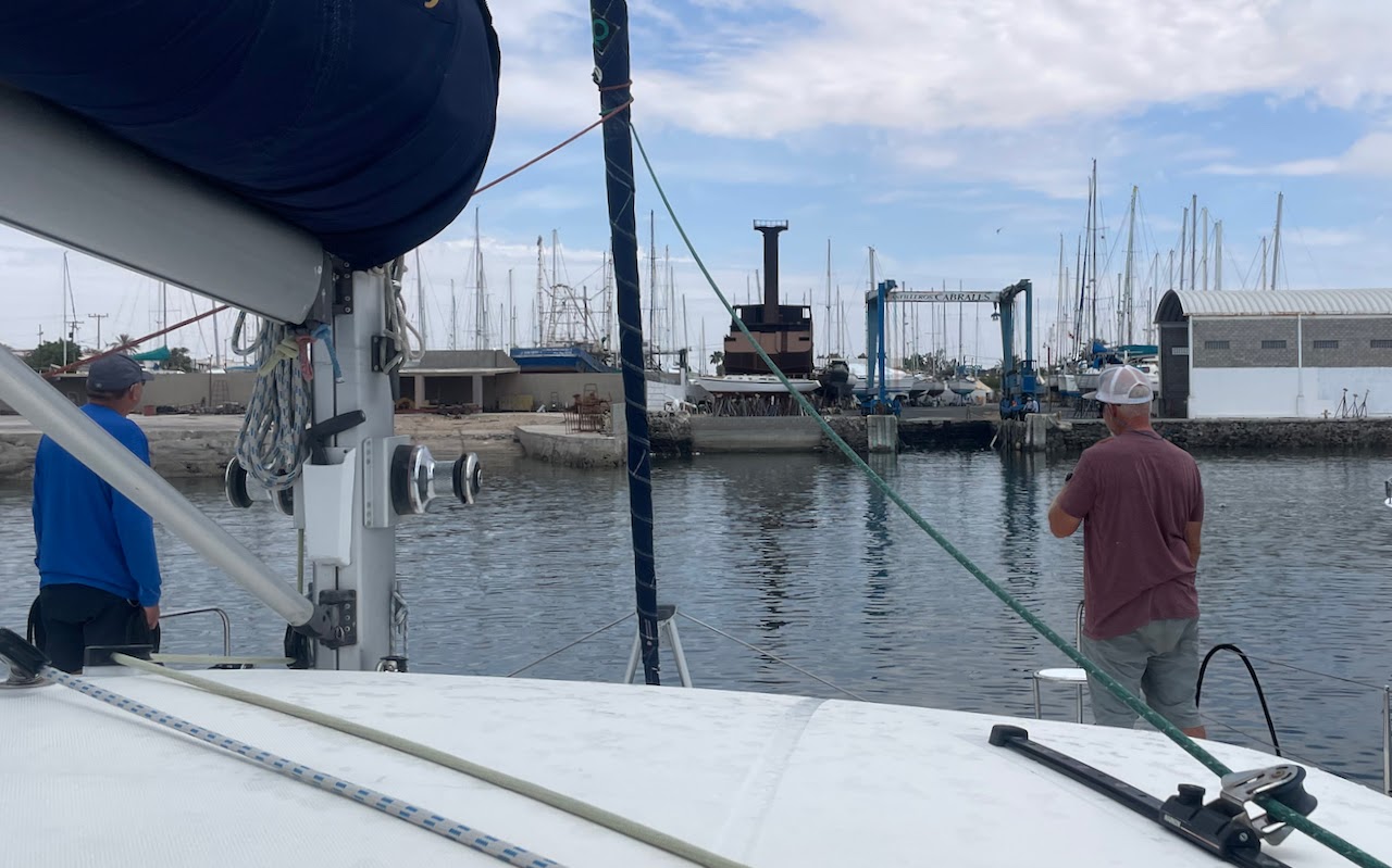
| Intermezzo all clean and shiny, only to gather dust in the Cabrales yard |
Tuesday, May 30, 2023
Back on Land, Sailing Life on Hold, the Sailing Intermezzo Book
Friday, May 19, 2023
Hauled Out and Laying Up
![]() |
| The Puerto Peñasco shrimp fishing fleet |
![]() |
| Sunrise approach Puerto Peñasco |
![]() |
| The medieval haul out slip at low tide |
![]() |
| Approaching the haul out slip at high tide |
![]() |
| Wayne The Line Handler |
Tuesday, May 16, 2023
The Journey and Life At Sea Drawing to An End
- Clean/wax interior fiberglass
- Clean/treat vinyl
- Polish wood
- Mildew prevention treatment, cabins
- Bag cushions, bedding, clothes etc.
- Clean fans
- Cull lockers
- DampRid lockers
- Drain dinghy hull
- Secure dinghy on davits
- Clean and cover dinghy
- Service outboard
- Shut off engine/house batteries
- Backup plotter data/settings
- Remove chart chips
- Remove IridiumGo!/Garmin Inreach/PLB
- Change engine oil
- Flush/replace engine coolant
- Wipe down engines
- Change fuel filters (primary/secondary)
- Fill fuel tanks/treat fuel
- Flush engine raw water system
- Change sail drive lubricant
- Clean stove
- Defrost/clean fridge/freezer
- Turn off propane
- Clean BBQ
- Remove food
- Remove trash
- Lubricate hatch seals
- Affix hatch and window covers
- Clean and dry bilges
- Wash and wax cabintop
- Polish stainless steel
- Cover forward windows
- Wash and wax hulls
- Replace engine hatch seals
- Secure portholes and hatches
- Clean, dry, stow kayaks and paddle board
- Remove portable batteries
- Pack clothes/personal items
- Bring log books
- Remove/stow lifebuoy/lifesling
- Cover electric winch switches
- Pickle watermaker, clean strainer
- Flush holding tanks
- Flush heads/relieve joker valves
- Clean shower sump
- Empty water tanks
- Change portable generator oil, run dry, drain carb
- Clean and grease windlass
- Exercise and lubricate bottle screws
- Remove bowsprit/furler
- Remove/store sails
Sunday, May 14, 2023
Bahía Willard, Overnight Passage, Next to Last Stop
The tiny settlement know as Papa Fernández takes its name from its centenarian founder Gorgonio (Papa) Fernández who first established a fish camp there in the 1950's. Later he moved there with his family (from Loreto in a rowboat), and has provided a welcome stop-over for Baja adventurers traveling the rugged dirt track which leads south along the Sea of Cortez from San Felipe to Calamajue Canyon and beyond. Papa passed away on February 20, 2001 at the age of 104 years.Early Spanish explorers recognized that the well-protected bay formed by Isla San Luis Gonzaga and the Punta Willard peninsula was a unique natural resource. The bay was first noted in written history in a report to the King of Spain by Fernando P. Consag, a Jesuit Missionary from Mission San Igancio who, with 6 soldiers and a few Indians in 1746, explored the Baja peninsula coast from the south up to the Colorado River Delta. As large ships were very scarce, this was done with four sail canoes.The original Spanish-dug well still supplies water to the Papa Fernández settlement. Remains of the Jesuit storehouse that was used by Spanish ships to supply Mission Santa Maria near Cataviña can be found nearby.
| The stony beach at the Papa Fernandez settlement |
![]() |
| Sunset at the start of the overnight trip to San Felipe |
Thursday, May 11, 2023
The Northern Sea of Cortez
![]() |
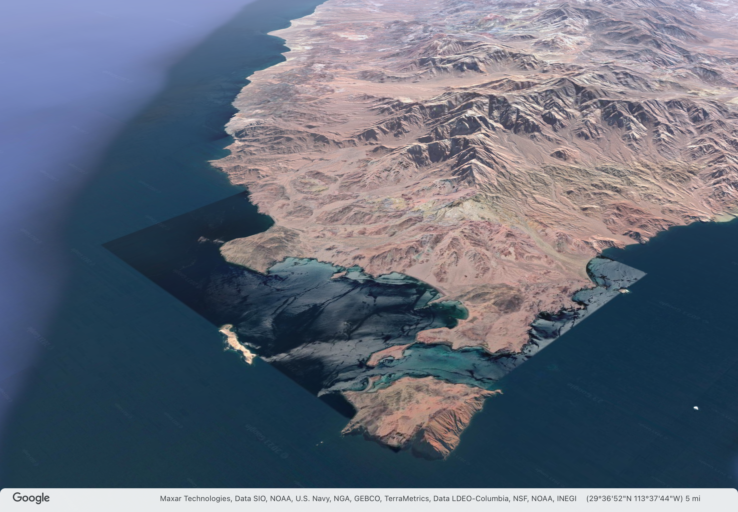
| Google Earth image of Puerto Refugio and the north end of Isla Angel de la Guarda |
In yesterday's post, I forgot to mention that Port Refugio is a new place in the Sea of Cortez for me, I've never been here before and this is the furthest north I've sailed. We are now most definitely in the northern Sea of Cortez, by several measures.
There are two states on the Baja California peninsula, Baja California and Baja California Sur (South). The border between them is roughly halfway along the peninsula right along the line of latitude 28.0 degrees N. The state of Baja California runs north to the US border, Baja California Sur runs south to Los Cabos at the tip of the peninsula. We crossed state border during the passage from Santa Rosalía to Bahía San Francisquito.
The US National Weather Service divides the Sea of Cortez (Gulf of California) into three zones, northern, central, and southern. The dividing line between the central and southern zones is also at about latitude 28N on the Baja side of the sea. The weather here is more closely affected by what's happening in the Great Basin of the US than the south. The winds are stronger in the winter, though I'm not seeing a big difference between north and south this time of year.
Puerto Refugio is at latitude 29.3 degrees N, almost 80nm north of this dividing line. It was the northern limit of John Steinbeck's voyage in 1941 on the Western Flyer which he chronicled in his book Log from the Sea of Cortez.
![]() |
| Voyage of the Western Flyer from Steinbeck's Log from the Sea of Cortez |
As the Western Flyer sailed north from Loreto, Steinbeck writes about the difference in the fauna of the southern and northern sea and the interesting puzzle it presented at the time to biologists:
Little fragments of seemingly unrelated information will sometimes accumulate in a process of speculation until a tenable hypothesis emerges. We had come on a riddle in our reading about the Gulf and now we were able to see this riddle in terms of the animals. There is an observable geographic differential in the fauna of the Gulf of California. The Cape San Lucas-La Paz area is strongly Panamic. Many warm-water mollusks and crustaceans are not known to occur in numbers north of La Paz, and some not even north of Cape San Lucas. But the region north of Santa Rosalia, and even of Puerto Escondido, is known to be inhabited by many colder-water animals, including Pachygrapsus crassipes, the commonest California shore crab, which ranges north as far as Oregon. These animals are apparently trapped in a blind alley with no members of their kind to the south of them.
The problem is: “How did they get there?” In 1895 Cooper advanced an explanation. He remarks, referring to the northern part of the Gulf: “It appears that the species found there are more largely of the temperate fauna, many of them being identical with those of the same latitude on the west [outer] coast of the Peninsula. This seems to indicate that the dividing ridge, now three thousand feet or more in altitude, was crossed by one or more channels within geologically recent times.”
Having reviewed the literature, we can confirm the significance of the Cedros Island complex as a present critical horizon (as Carpenter did eighty years ago) where the north and south fauna to some extent intermingle. Apparently this is the very condition that obtained at Magdalena Bay or southward when the lower Quaternary beds were being laid down. The present Magdalena Plain, extending to La Paz on the Gulf side, was at that time submerged. Then it was cold enough to permit a commingling of cold-water and warm-water species at that point. The hypothesis is tenable that when the isotherms retreated northward, the cold-water forms were no longer able to inhabit southern Lower California shores, which included the then Gulf entrance. In these increasingly warm waters they would have perished or would have been pushed northward, both along the outside coast, where they could retreat indefinitely, and into the Gulf. In the latter case the migrating waves of competing animals from the south, which were invading the Gulf and spilling upward, would have pocketed the northern species in the upper reaches, where they have remained to this day. These animals, hemmed in by tropical waters and fortunate competitors, have maintained themselves for thousands of years, though in the struggle they have been modified toward pauperization.
So, the Baja peninsula was once crossed by channels, roughly at the same latitude as the state border and this allowed the Pacific and Sea of Cortez fauna to mix. When the channels disappeared, a segregation of species occured. My own observations leave me with no doubt that the ecologies of the northern and southern Sea of Cortez are quite different. The water is colder here, there shores more rocky, the topography, above and below the water, more severe. It is less tropical here, more temperate. I'm sure a marine biologist would observe big differences in the marine life underwater.
From a human perspective, the northern sea is more remote, less people, less boats. There is less of a vacation feel to the place. All the other sailors I've spoken to (and there haven't been many) are also heading to Puerto Peñasco with purpose, to haul out for hurricane season. Apart from the occasional small recreational fishing boat from nearby Bahía Los Angeles, the only other boats have been a few small rough steel commercial fishing boats.
From this point on, I will be traveling waters and stopping in anchorages new to me (and uncharted by the Western Flyer). Tomorrow morning, we leave for Bahía Willard.
Wednesday, May 10, 2023
A Beautiful Place
![]() |
| Middle Bight, Puerto Refugio at sunset |
![]() |
| Puerto Don Juan at low tide, clam bed extraordinaire |
![]() |
| Isla Angel de la Guarda |
![]() |
| Puerto Refugio landscape |
![]() |
| Intermezzo anchored in the West Bay of Puerto Refugio, Isla Angel de la Guarda beyond |
Saturday, May 6, 2023
Sea Lions, Thieving Gulls, Electronics Fail
Puerto Don Juan, Baja California
| Sunset through "The Window" at Puerto Don Juan |
We are sitting at anchor in the very protected harbor of Puerto Don Juan, Stop #7 on the way to Puerto Peñasco. It has been a rest day after sailing all day yesterday to get here. The weather is beautiful, sunny, clear, cool and was breezy most of the day. The waters in the anchorage are calm, but cold. I dipped the thermometer in and it registered only 68℉ (20ºC). So any swims will be short-lived or with a wetsuit.
This place is teeming with sea lions hunting for fish solo or in packs. The larger, older ones seem to hunt rather languidly by themselves, the smaller, younger ones hunt in groups, swimming fast, arcing out of the water as they pursue whatever it is there are after. The larger ones are noisy, grunting as they hunt and barking at each other over fishing territory.
The sea lions often gather in a raft-up of a dozen or more to rest and warm up, floating on their backs with their fins in the air. The sun warms the blood in the thin tissue of the fins which in turn warms the rest of the sea lion's body. They jostle for an inside position among the group, where the water is warmed by collective body heat.
There are also lots of pelicans fishing. Harassing both the sea lions and the pelicans are nasty thieving seagulls. As soon as a fish is caught by either, a dozen seagulls gang up on the catcher and try to steal the fish or snatch a morsel from beak or mouth. It is like watching a mob attack, very ugly. The pelicans deal with the attacks stoically; they don't have any other choice. The sea lions seem to get annoyed and quickly dive under the surface to get away from the mob.
The whole place is in a state of constant activity, except for the lazy humans sitting on their boats just watching.
It was a mostly enjoyable sail here yesterday, except for some mild-to-moderate bashing for a couple of hours against wind and chop, and a worrying hiccup with the autopilot and instruments.
As we crashed down off a small but very steep wave, the autopilot's alarm went off, the display informed me, that there was "No Heading Data", and the autopilot disengaged. I tried to re-engage the autopilot but was not successful, further informed by the display, "Startup Required". I'd never seen that message before and didn't know what I needed to do, but turning the autopilot off and back on seemed like a good move. I tried that, but no luck.
All the instruments and the autopilot are interconnected on a network, so I figured my next step was to turn everything off, wait ten seconds, and turn everything back on. The universal magic recipe for fixing electronic devices. Before I did this, I gave some thought as to what I would do if everything stopped working as a result. It was daylight, good weather, a straightforward route, an easy anchorage to enter and I was running redundant navigation on my iPad, so I decided I could take the risk.
I shut off everything, counted to ten, and flipped the power back on. I was surprised and mildly alarmed to be informed that we had no GPS (for fixing our position) and no AIS (for collision avoidance). But the autopilot was working, as was the wind instrument. However, to my dismay, the depth sounder was just showing dashes. Bummer.
The GPS and AIS sorted themselves out in about ten minutes, which was a relief. The depth sounder, however, remained uninformative. Until then, I hadn't really appreciated what an essential piece of equipment the depth sounder is. We rely on it to avoid running aground, for navigating in shallow waters and for anchoring.
I had some hope that the depth sounder wasn't displaying any numbers because I turned it back on when we were in water over a thousand feet deep and the depth sensor only works to a few hundred feet. But whenever we have been in very deep water, the depth sounder flashes the numbers of the last recorded depth, it doesn't just display dashes. So, I was worried and needed a backup plan for anchoring and perhaps the rest of the trip. My backup was to tie a couple of diving weights to a long line that I knotted every fathom. A lead sounding line, just like in the old days. I chuckled at the idea of lowering the line, feeling two knots pass through my hand and calling out "Mark Twain", the twelve-foot depth that Samuel Clemens used as his pen name.
Fortunately when we got into water in the hundreds of feet deep, the depth sounder flashed numbers instead of dashes. Nonsense numbers, but just like it always has in deep water. When we got into less deep water, the depth on the sounder matched the soundings on the chart. All was good again.
I don't know what caused the hiccup in the electronics. Maybe the fluxgate compass didn't like getting jostled by the wave, but that has never happened before. I checked all the network cable connection, they all seemed okay, but maybe one shook loose. The autopilot is the data hub, so I'll open up its case and check the connection inside later. And if I can find the fluxgate compass (its location alludes me at present), I'll examine it as well.
What this experience has taught me is that the depth sounder is an essential instrument and that the autopilot is nearly essential for singlehanded sailing. I plan on installing a redundant depth sounder as part of Intermezzo's refit. Another Leopard owner has rigged up a system to use a tiller pilot as a backup. This simple, relatively inexpensive system would not only steer the boat if the main autopilot failed, it would also serve as emergency steering if the main steering system failed. Two more projects for the (long, long) refit list.
I'm planning on staying here for a day or two before heading to Puerto Refugio. Northwest winds are suggested for Wednesday. If they materialize, I'm going to sit them out somewhere.